
Raven enhances collaboration for security site planning
October 12, 2023
By
Canadian Consulting Engineer
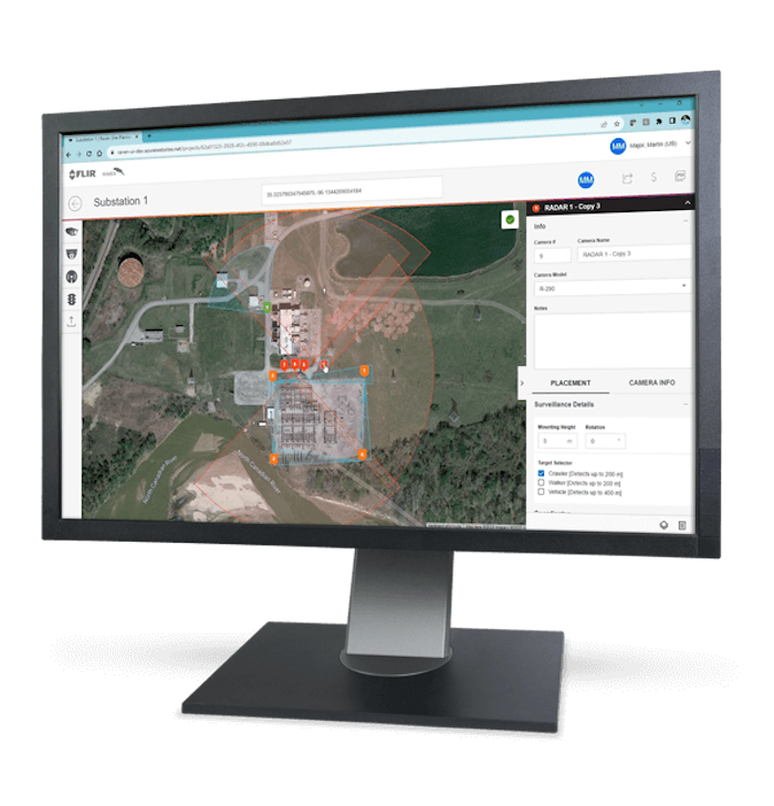
Image courtesy Teledyne FLIR.
The latest iteration of Teledyne FLIR’s Raven professional security site planning web tool offers real-time collaboration capabilities between users, to help them configure and place cameras in a specified location.
The tool offers controls to simulate mounting height, rotation, range and image detection, using Google Maps satellite imagery to help users place cameras in co-ordinated locations. As one user can now share a report with another, it has become easier to work on a plan together, reduce revision time and improve accuracy.
Site planners can test various configurations to ensure proper placement and coverage, switching between camera models before or after the layout is built, and then use colour-coded detection zones to differentiate between radar, thermal and visible camera installations. They can also add site plan notes a the point of camera placement and when generating a final report.