
Carlson introduces cloud-based photogrammetry solution
May 21, 2018
By
CCE
This new service gives users the ability to generate interactive 3D maps of sites using aerial, oblique, or terrestrial images.
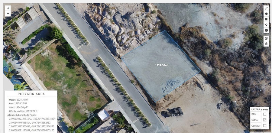 Carlson Software has introduced Carlson PhotoCapture, the first cloud-based standalone product and photogrammetry solution offered on the Carlson product line.
This new service gives users the ability to generate interactive 3D maps of sites using aerial, oblique, or terrestrial images. Once the images are uploaded, Carlson PhotoCapture will create an orthomosaic photo to piece the site together.
By turning pixels into accurate 3D models, PhotoCapture allows users to set control points to fine-tune the survey data. Users then have the freedom to view and edit the 3D map immediately upon upload completion from anywhere with an internet connection.
Carlson PhotoCapture can be partnered with Carlson Precision 3D Topo and Carlson Point Cloud to extract data from the generated 3D model. Customers are given three tiers, ranging from 5GB to infinite storage, to choose from. PhotoCapture stores projects indefinitely so customers can keep a project for as long as needed.