
HDR wins GIS award for Ontario Line subway planning portal
July 26, 2022
By CCE
The firm serves as technical advisor for the public-transportation project.
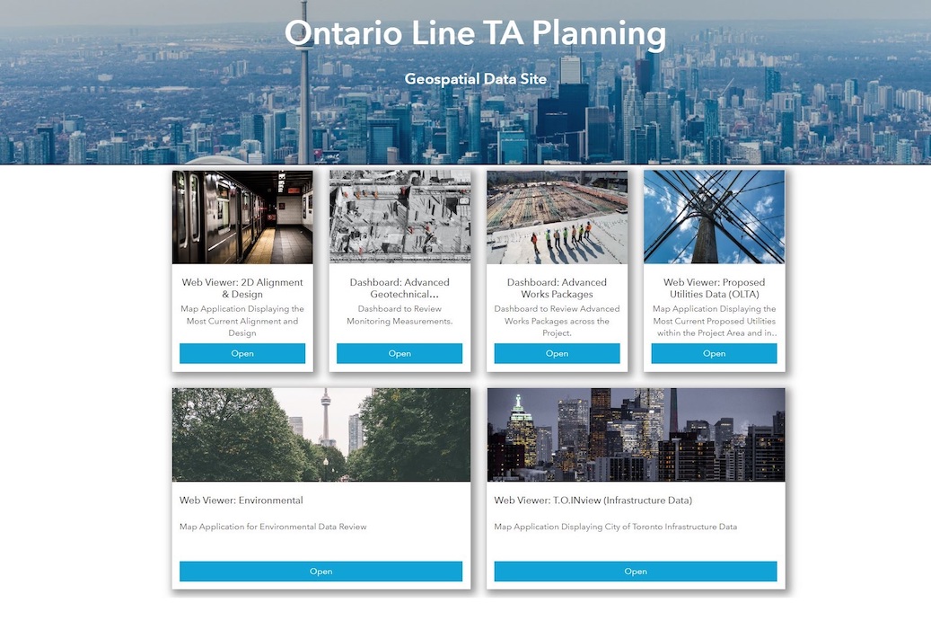
Screenshot courtesy HDR.
Geographic information system (GIS) software developer Esri has honoured consulting engineering firm HDR with a special achievement award for its work on the $10.9-billion, 15-station Ontario Line subway project in Toronto.
HDR used Esri’s ArcGIS Hub cloud platform to develop the Ontario Line planning portal (screenshot pictured), which is assisting nearly 1,000 staff on the project team. The portal combines GIS, computer-aided design (CAD) and building information modelling (BIM) data for users reviewing two-dimensional (2-D) alignments, properties, utilities, environmental impacts and three-dimensional (3-D) station designs. This data integration enhances efficiency for team members by removing the need to duplicate information from one system for another.
“Designers, project managers, client representatives and team members who don’t typically work in advanced design platforms can access complex and incredibly large data sets through a single web link,” says HDR transportation data acquisition and reality mesh director Cameron Schaefer, P.E.
Esri chose the firm for the annual award from more than 100,000 of its clients round the world. HDR serves as technical advisor for the nearly 16-km Ontario line subway, which will run from Exhibition Place through downtown Toronto to the Ontario Science Centre.
Meanwhile, HDR is becoming a platinum partner in the Esri partner network. It will be one of 17 firms at that level.