Generic selectors
Exact matches only
Search in title
Search in content
Post Type Selectors
Search in posts
Search in pages
Subscribe
Magazine + Enews
Enews
Subscribe
Magazine + Enews
ENews
Menu
Top 10 Under 40
News
Features
Products
CCE Directory
View Directory
Add Listing
Audio/Video
Podcasts
Webinars
Events
Industry Events
Virtual Events
Awards
Entry Information & Forms
Press Releases
Showcase of Entries
About The Awards
Past Winners
Magazine
Digital Edition
E-News
About
Advertise
Contacts
Jobs
×
Browse
Awards Entry Information & Forms
News
Features
Products
Podcasts
Events
CCE Directory
Virtual Events
Job Board
Explore
Buildings
Business & Professional
Companies & People
Energy
Engineering
Environmental
Industrial
Transportation
Water & Wastewater
Women in Construction
Magazine
Digital Edition
E-News
About
Advertise
Contacts
Feedback
Image
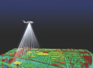
Digital Modelling Tools
1000377461-1000377462
I agree
We are using cookies to give you the best experience on our website.
By continuing to use the site, you agree to the use of cookies. To find out more, read our
privacy policy
.