Ontario government proposes tighter land development rules
May 17, 2016
By
CCE

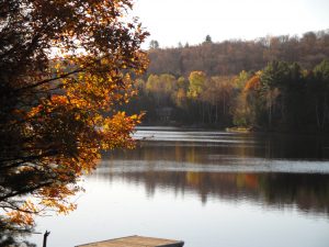
Photo: BP/CCE.
The Ontario government has announced changes to four of its land management plans in southern Ontario. The changes will affect the municipal development of roads, waterways and infrastructure.
Prepared in the wake of a report prepared by an advisory panel headed by former Toronto mayor David Crombie, the proposals affect four land plans that overlap geographically. They are the Growth Plan for the overall Greater Golden Horseshoe, the Greenbelt Plan (covers a huge swath up to Lake Simcoe), the Oak Ridges Moraine Conservation Plan (north and east of Toronto), and the Niagara Escarpment Plan. This Greater Golden Horseshoe is forecasted to add about 4 million people over the next 25 years, amounting to 13.5 million. It is Canada’s fastest growing urban region.
The changes are to protect the natural environment and water bodies, to reduce urban sprawl and support transit, and to preserve farmland. They also take into account climate change. Also, municipalities would have to conduct climate change vulnerability risk assessments when planning or replacing infrastructure. They would also have to develop storm water management plans and address flood risks in their settlement areas.
Introduced following a report prepared by an advisory panel headed by former mayor David Crombie, the proposals affect four plans which overlap each other geographically. They are the Growth Plan for the Greater Golden Horseshoe, the Greenbelt Plan (covers a huge swath up to Lake Simcoe), the Oak Ridges Moraine Conservation Plan (north and east of Toronto), and the Niagara Escarpment Plan. The Greater Golden Horseshoe is forecasted to add about 4 million people over the next 25 years, amounting to 13.5 million. It is Canada’s fastest growing urban region.
The government is proposing that the Greenbelt-level protections expanded beyond the Greenbelt for natural heritage systems such as wetlands, woodlands and rivers. This change would mean municipalities have to protect these systems in their official plans. A total of 21 major urban river valleys and seven associated coastal wetlands would be added to the protected Greenbelt.
Other specifics include:
– zoning to allow higher density along transit corridors;
– at least 60% of annual new residential development to be within the existing built-up area of a municipality;
– stronger environmental, financial and planning criteria for new development;
– enhanced compatibility between farm uses and non-farm areas such as highways and urban areas;
– requirement for municipalities to complete watershed planning before they plan settlements, infrastructure or major developments;
– more specific direction for municipalities to protect land reserved for rail, road or hydro corridors;
– clearer direction to help municipalities take an integrated approach to planning.
The province is holding public open houses this month and next on the proposals, and has posted them online at Ontario.ca/landuseplanningreview.